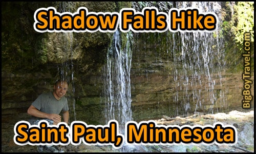
Saint Paul Shadow Falls Hike:
Location: 30 North Mississippi River Blvd, Saint Paul (West Summit Avenue)
Hiking Distance: 0.2 Miles (Details Below)
Hours: Parking open sunrise to 10pm
Cost: Free
Visit Overview:
Shadow Falls, along with Minnehaha Falls (more info), is one of two urban waterfalls in the Twin Cities where you can actually go behind the water flow. Shadow Falls isn’t as big as Minnehaha, but with its hidden wooded location, you’ll feel like you aren’t in the city at all.
Related Article: Summit Avenue Walking Tour.
History Of Shadow Falls:
Starting in the mid-1800s Shadow Falls was a very popular destination for picnickers, hikers, and riverboat tourists. In the 1880s investors proposed to build a Summer resort. Many local, however, encouraged the city to develop the area into a park for public use instead. The park was fully set in motion in 1899 when John Ireland, Archbishop of St Paul, donated 18 acres of land including the Falls to the city. The Shadow Falls Park opened in 1902 mostly left undeveloped on purpose to retain its natural state, but many nearby smaller streams were combined to maximize the flow over the Falls. The final addition to the park was the 36-foot-tall memorial column dedicated to the soldiers and sailors of World War I by the Daughters of the American Revolution in 1923.
Since the peak of the park in the mid-1900s, the growth of nearby neighborhoods has taken water from some of the small streams contributing to the Falls reducing its flow. Even with the reduced flow a hike to the Falls today and the impressive views above the Mississippi River are a hidden gem of St Paul. With the waterfalls’ prime location make sure to pair it with our very popular Summit Avenue Walking Tour to enhance your experience of the neighborhood.
Hiking To Shadow Falls:
Take Summit Ave west all the way to the Mississippi River where you’ll find the parking lot. From the lot walk down to the River overlook and follow the worn wooded trail about 0.2 miles around the top of the Falls. After passing over the falls the trail winds down to the base of the Falls.
The best time to go is earlier in the Spring or after a fresh rain is best when the falls have the most water flow. The trail is dirt and can be muddy if you go too soon after a rain. Consider bringing bug spray if going right after a rain. The flow of Shadow Falls is basically nothing in the Winter.
How Were Shadow Falls Formed:
Shadow Falls are hidden in a deep ravine at the West end of Summit Avenue where Shadow Falls Creek flows over layers of limestone, shale, and sandstone. The layers expose the recent geological history of the Mississippi River Gorge, and are part of the story of Glacial River Warren and the retreat of St. Anthony Falls more than 11,000 years ago. Saint Anthony Falls far out dates Shadow Falls, stretched all the way across the Mississippi River, and is thought to have been one of the biggest waters ever in the Americas.
Shadow Falls is actually one of several small waterfalls cut into ravines along the sides of the gorge. When the soft St Peter Sandstone was eroded by the seepage of groundwater springs, the ravine and waterfall were created by the collapse of the overlying layer of hard Platteville Limestone. The Decorah Shale layer contains excellent examples of Ordovician fossils deposited more than 400 million years ago.


